TAMPA, Fla. — Hurricane Milton is forecasted to make landfall on Wednesday night as a major storm, despite fluctuating between a Cat 5, Cat 4, and Cat 3.
Florida Gov. Ron DeSantis declared a State of Emergency for 35 counties in Florida and numerous counties issued mandatory evacuations as forecasts show Milton tracking toward the Sunshine State's west coast.
Residents throughout the state are trying to make their way northward outside of the storm's path as the National Hurricane Center forecasts between 10 and 15 feet of storm surge and between 5 to 12 inches of rainfall.
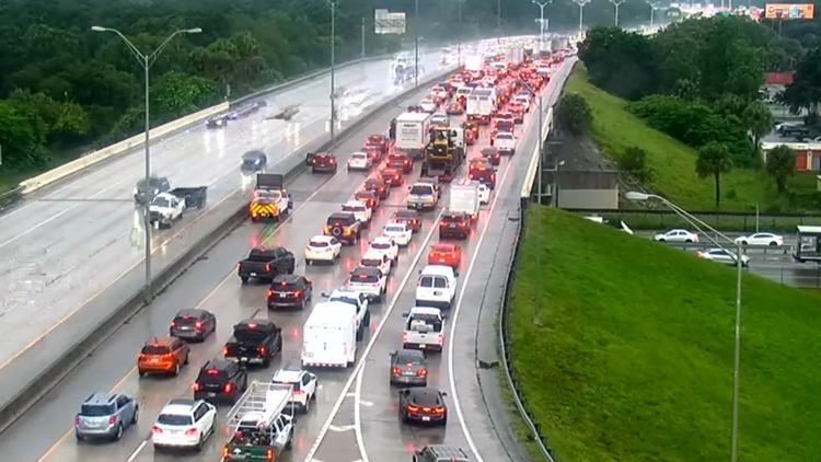
Florida 511's live cameras for evacuation traffic:
Evacuees can use Florida 511's website to watch live cameras and check road conditions before they start their journey away from the storm.
The state's "official source for real-time traffic information" offers live breakdowns by region and roadways. The service also allows residents to create personalized evacuation routes by setting up an account on the site.
The Florida Department of Transportation also set up an Emergency Shoulder Use (ESU) Corridor for Hurricane Milton evacuees on Eastbound I-4 and portions of Northbound I-75. Law enforcement and signage are set up to alert motorists on when to enter and exit the shoulder.
Milton came on the scene on Saturday as a tropical storm. Early Monday morning, Milton kicked off a rapid intensification starting as a Category 2 storm. By noon, the storm had strengthened to a large Category 5 hurricane.
As of the latest advisory, the storm is about 560 miles southwest of Tampa with maximum sustained winds at 155 mph. Earlier on Monday, Milton had maximum sustained winds of 180 miles per hour.
It is moving east-northeast at 12 mph.
"While fluctuations in intensity are expected, Milton is forecast to remain an extremely dangerous hurricane through landfall in Florida," the National Hurricane Center said.


