HUNTSVILLE, Ala. — If one were to look at the climate stats for Wednesday they would see numbers that make it appear to have been a warm afternoon. The Huntsville International Airport saw a high temperature of 65°. The Muscle Shoals Regional Airport also saw a high temperature of 65°. The interesting note here is that these "High Temperatures" occurred between 12:00 AM - 6:00 AM Wednesday.
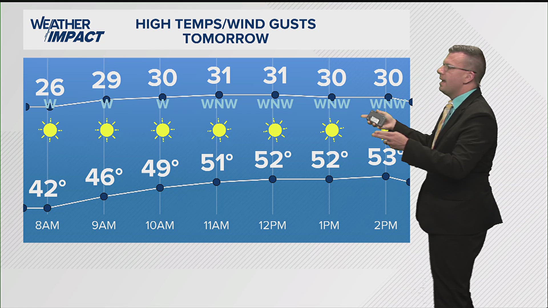
Wednesday night and Thursday morning will be cold. We'll see temperatures drop into the upper 30s and low 40s. We will not see temperatures climb Thursday afternoon. We're only looking at high temperatures in the low and mid-50s. We should be in the low 60s this time of year.
The other noticeable feature Thursday will be the breezy conditions again similar to what we saw on Wednesday. Sustained winds will be 10-15 mph while wind gusts will be 25-30 mph. Make sure to secure outdoor decorations so they do not end up in your neighbors yard.

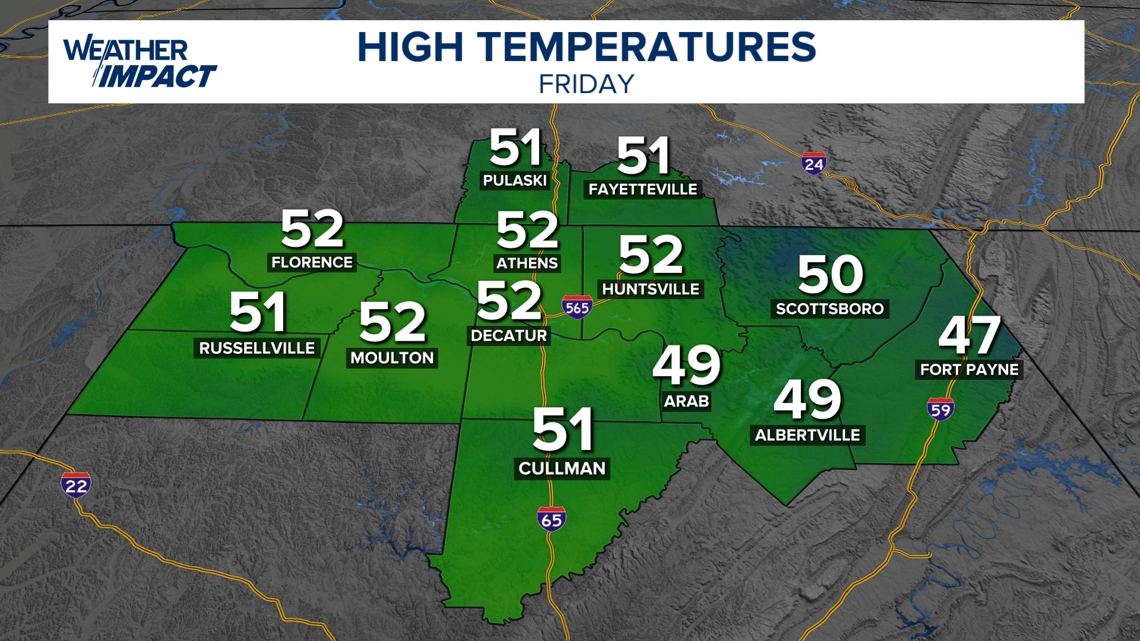
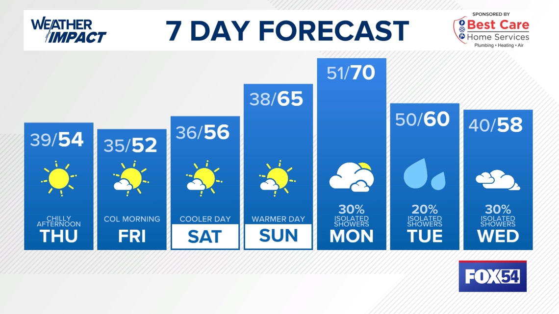
We'll stick with the mid-30s in the morning and low to mid-50s in the afternoon for Friday and Saturday. Temperatures will climb again Sunday and Monday of next week.
While temperatures will be in the 30s, we will not see temperatures get to the freezing point. The Huntsville International Airport has yet to see 32° this season. The latest first 32° or lower temperature of the season is December 5, 1978.


Thanksgiving isn't just a big day, it's a big week! Final preparations are made and the traveling begins. Locally we wanted to acknowledge a few elements that are in the long-range forecast. Rain will return to the Tennessee Valley later next week and could be around for Thanksgiving.
Temperatures after recovering this weekend will drop again early next week, and could stay lower with highs in the 50s on Thanksgiving and Black Friday.
How do these elements impact travel? It's too early to tell. The one thing we can tell you is that rain could be a problem for those that smoke or fry their Thanksgiving Turkey.
7-Day

Winter Outlook

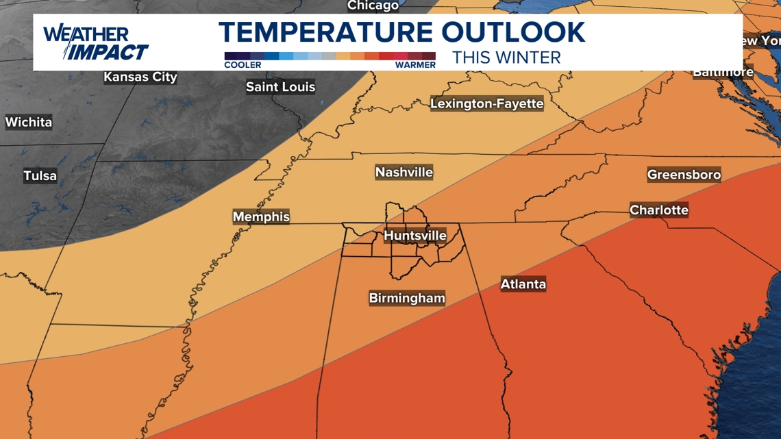
The Climate Prediction Center has released their winter outlook for this winter season and given the La Niña weather pattern, the Tennessee Valley is expected to see above average temperatures this winter, but that doesn’t mean our temperatures won’t get cold at all.

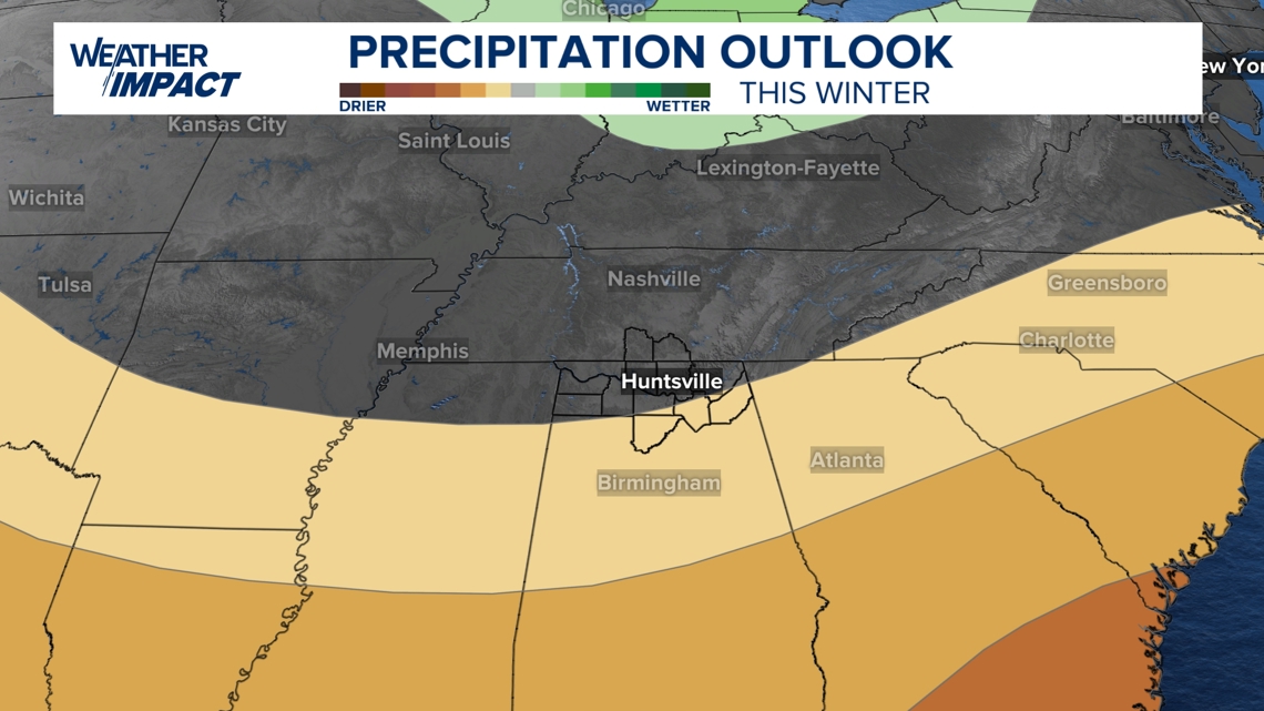
As for the precipitation outlook for the winter, most of the Tennessee Valley looks to have a near-average precipitation amount, but some of us (the south-eastern portion of the area) will see slightly drier conditions than usual.
Emily Explains
Meteorologist Emily Owen has started a new digital only series, 'Emily Explains', on FOX54+ and fox54.com where she'll dive into the science behind our favorite types of weather!
The Tennessee Valley's FOX54 Weather Network Facebook Group
Be sure to join our Facebook group, The Tennessee Valley's FOX54 Weather Network!

