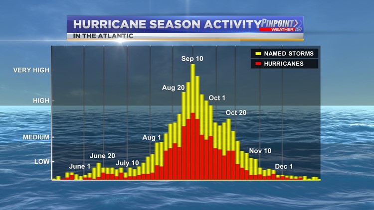
HUNTSVILLE, Ala. — The 2020 season is actually off to a quick start in the Atlantic Ocean. We're still at the point in the season where on average our tropical activity is low, but now we're talking about two different disturbances. One of those disturbances is on the verge of getting a name. Right now that storm is simply Tropical Depression Seven.
RELATED: Tennessee Valley Weather Photos
Normally we do not see an uptick in activity until we get to the beginning of August. Our peak for tropical activity is late August through the middle of September. From late September through the end of hurricane season we see a steady decrease in tropical activity.

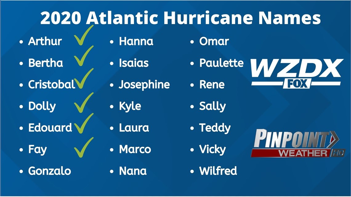
With that in mind, take note of the fact that we have already seen six named storms in the 2020 season. If Tropical Depression Seven gets a name it would become Gonzalo.
RELATED: Reports: NFL cancels 2020 preseason
Between 1966 and 2009 the average date we would see our sixth named storm would be September 8th. Obviously that means seeing our sixth named storm in late July puts us ahead of schedule.

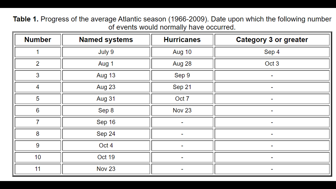
The good news here is that we have yet to see a hurricane and therefor have yet to see a category three hurricane. During the same time period the average first hurricane is August 10th and the first Category three or higher is September 4th.

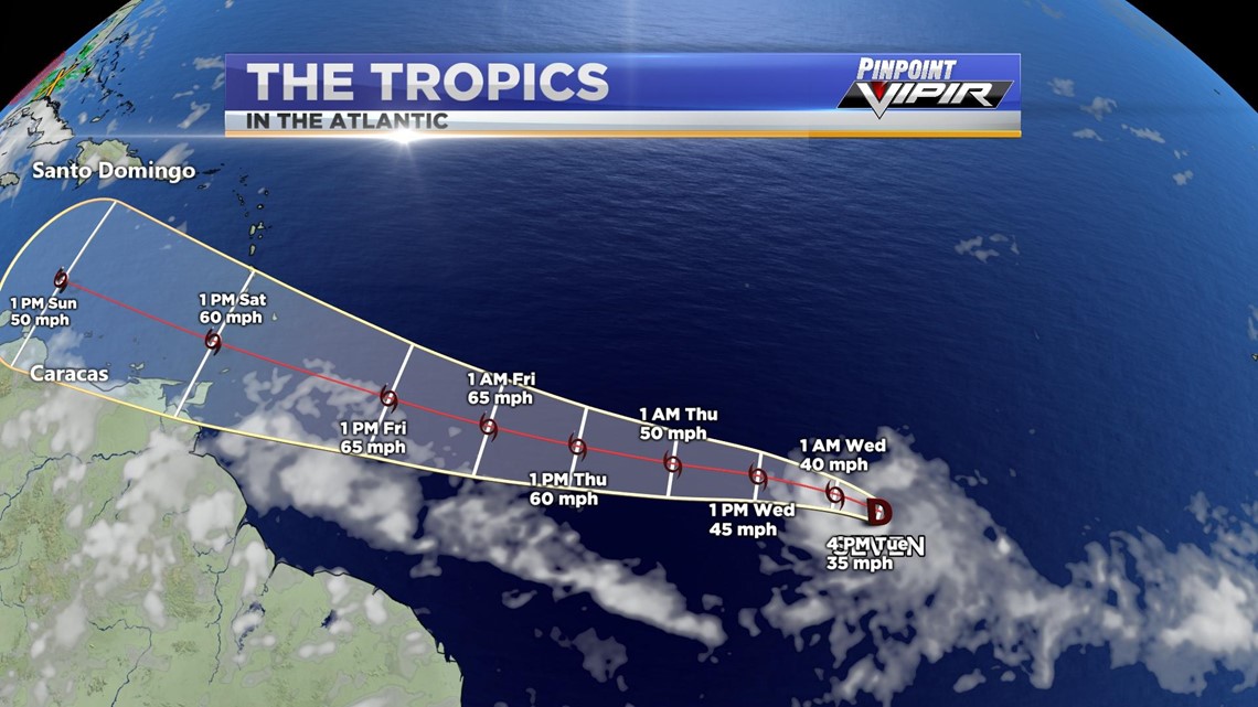
So here's Tropical Depression Seven. It is currently well out in the Atlantic, but will move towards the Lesser Antilles and the Caribbean through the rest of the week and the weekend. During that time it does look like seven will continue to strengthen into a decent Tropical Storm. Again if it gets a name (and it looks like it will) it would become Gonzalo.

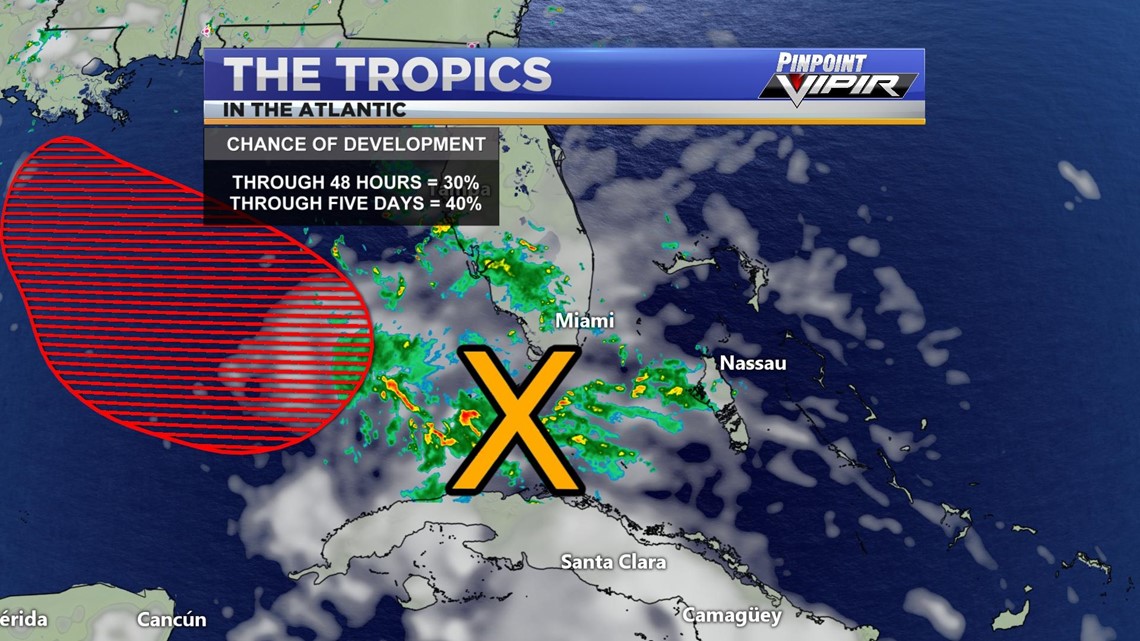
There is also a much closer disturbance north of Cuba. This disturbance is fairly disorganized and has a small to medium chance at further development through five days. It does look like this disturbance will enter the Gulf of Mexico in the coming days.


